



EXCLUSIVE: UKHO trials highlight S-100 navigation potential
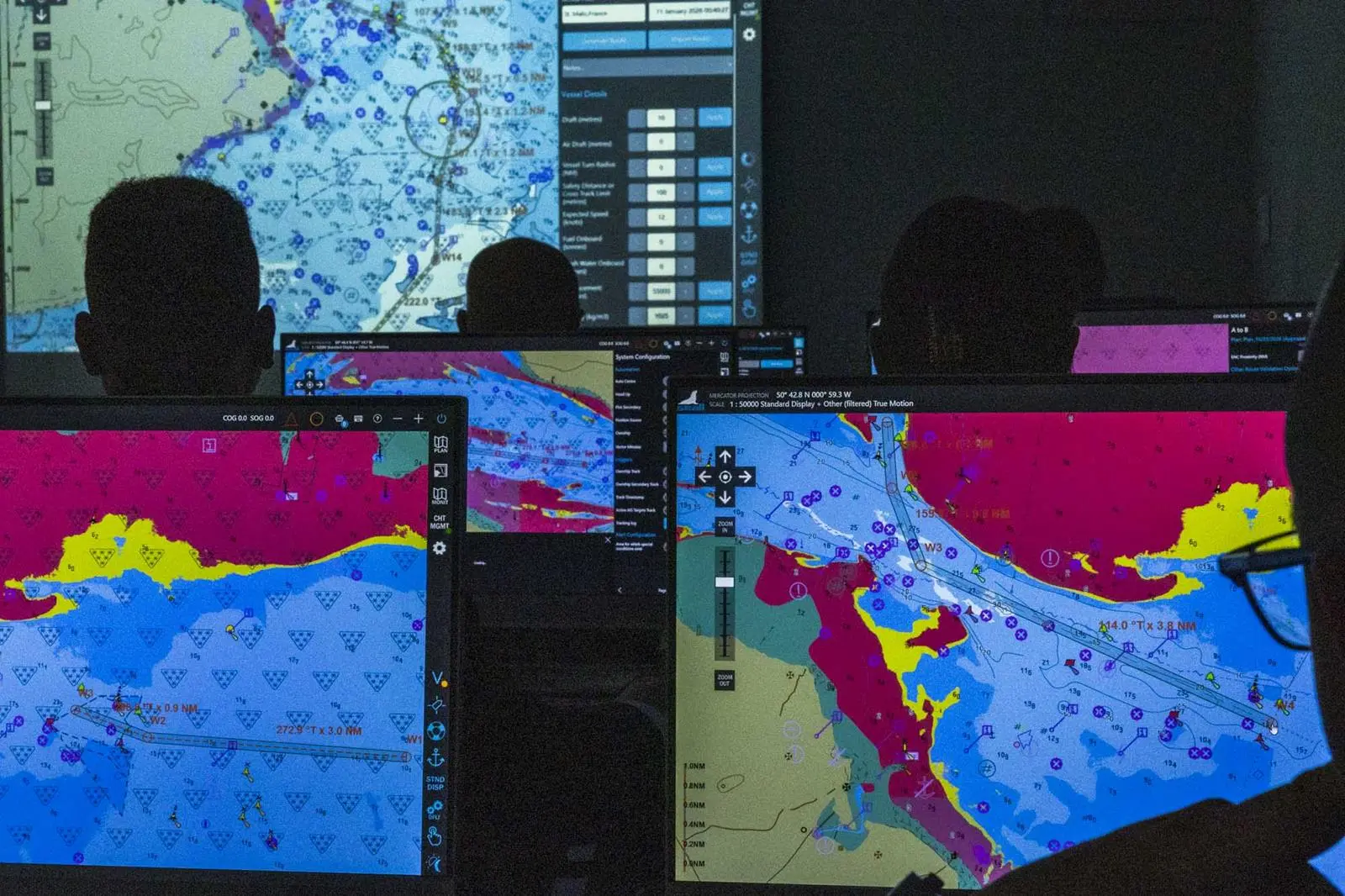
Conducted alongside the Angelicoussis Group, Minerva Marine and NorthStandard, the programme brought together bridge teams from tanker, LNG and dry bulk fleets to evaluate how S-100 data layers influence situational awareness, voyage planning and navigational safety compared with the existing S-57 framework.
The trials were carried out using full mission bridge simulators at training facilities operated by Minerva Marine and the Angelicoussis Group in Athens. Participants undertook a simulated voyage from Portsmouth Pilot Station to Fawley Oil Terminal, selected for its constrained waters and tidal complexity.
Tom Mellor, head of Technical Partnerships at the UKHO, told The Motorship that the industry’s current navigation framework has limitations when operating in dynamic marine environments.
“The navigational data that mariners rely on today is built on S-57, a standard that has served the industry well since 1992,” said Mellor. “Under the S-57 framework, an Electronic Navigational Chart provides a static picture of the maritime environment.”
“That means it cannot, for example, tell a mariner how much water is under the keel at a given moment, or how the navigable area changes over time.”
Mellor said S-100 has been designed to integrate multiple layers of real-time and dynamic information into a single ECDIS display, including bathymetry, water levels, surface currents and navigational warnings.
“This includes high-resolution bathymetry, water level data, surface currents, and navigational warnings, building on S-57’s proven foundations while introducing the flexibility and capability that modern maritime operations increasingly demand,” he said.
Rolling out in 2028
According to the UKHO, type-approved S-100-compatible ECDIS systems are expected to become commercially available in 2028, with all newly installed or retrofitted ECDIS required to support S-100 from January 2029.
The simulator exercises introduced crews to five S-100 product specifications: S-101 electronic navigational charts, S-102 bathymetric surface data, S-104 water levels, S-111 surface currents and S-124 navigational warnings.
Participants initially planned the Portsmouth to Fawley route using only S-57 data before progressively introducing S-100 layers to compare operational outcomes.
Mellor said the exercises demonstrated how additional environmental information could unlock safer and more efficient routeing options.
“Using S-57 data alone, participants adopted a more conservative routing approach, validating five of the 20 planned waypoints,” he said.
“Once S-100 layers, like tidal depth information and timing adjustments, were applied, crews identified additional navigable water and ultimately validated all 20 waypoints as suitable for transit.”
Significant operational benefit
Participants also identified significant operational benefits from improved under-keel clearance calculations and more detailed understanding of seabed profiles in constrained waterways.
“One notable operational benefit was a more precise understanding of the seabed profile, revealing navigable water that would otherwise not be deemed safe,” Mellor said.
“Participants also observed that combining these layers created a more dynamic understanding of how safe navigable water changed over time during the transit window, particularly in constrained or tidal approaches.”
Surface current data was identified as particularly valuable during pilotage, berthing and navigation through confined waters, where tidal flows and directional shifts can significantly affect vessel handling.
The trials also examined the practical challenges associated with wider S-100 adoption, including display usability, ECDIS integration and mariner training requirements.
“Participants were open about the need for clear, well-designed displays,” Mellor said. “S-100 gives mariners more information, but more information does not automatically mean better navigation.”
He added that scenario-based training and simulator familiarisation would be critical to ensuring crews can interpret S-100 data effectively during time-critical navigational decisions.
“The need for mariners to receive comprehensive training and clear operational guidance was widely highlighted,” Mellor said.
The UKHO said collaborative simulator testing is expected to play an important role in supporting industry preparedness ahead of the wider rollout of S-100 systems.
“Simulator-based testing offers something that live sea trials alone cannot – the ability to explore complex scenarios in a controlled environment,” Mellor said.
“These trials brought together hydrographic experts, real-world mariners, insurance-sector stakeholders and ECDIS technology developers, all engaging with the same scenarios at the same time.”
Related Articles
 ENERGY SAVING DEVICES
 LNG
LNG
 ALTERNATIVE FUELS & LUBRICANTS