



Digitalisation breaking down ship-port disconnect

“It starts with a single asset, the vessel, and it builds from there,” says Osku Kälkäjä, Head of Digital Business at ABB Marine & Ports. “The vessels and shipowners are working globally, but the ports are working locally, so to put them together, that requires time and cooperation.”
There are a huge number of different variables that go into minimizing emissions, he says. These include when the vessel leaves port, manoeuvring, pilot boarding and transits that can sometimes vary due to commercial considerations from what was initially planned. However, digitalisation is important no matter what size a company is. “If you miss the train, you will get nowhere,” he says.
ABB and Wallenius Marine have developed OVERSEA – a fleet support centre available as a service. OVERSEA leverages ABB’s Ability™ Genix Industrial Analytics and AI suite, and combines it with fleet management knowledge from Wallenius Marine, to help ship operators decrease fuel consumption and reduced emissions. Its scope includes hull and machinery, speed and route planning, as well as emissions and carbon intensity reporting.
Data flow from the power and propulsion system is key to maintaining propulsion efficiency, and other collaborations build from there. For example, knowing the ETA early in the voyage allows a vessel to set the power applied to the main engine at the right constant level to achieve the time slot. Søren Andersen, Chief Executive Officer – StormGeo, says that ships “rushing” to port and then subsequently waiting outside port (sometimes for days) is probably the largest addressable waste of CO2 in the shipping industry today. StormGeo is developing solutions that can improve the interface between port and ship to improve or achieve just-in-time arrival.

Integrating port data into voyage optimisation
For example, the company has run a pilot on specific ports, proving that it can predict port closures due to weather and swell conditions with very high accuracy. “We are also developing ways to map port congestions with the same purpose. By making these predictions available to our shipping customers, they can better plan their voyages and take such events into account. The benefit of these initiatives is that we do not need many stakeholders to be involved in the work. A few data sources are sufficient to develop these solutions.
“The challenge we, as an industry, are looking at is complex, but there shouldn’t be any hard showstoppers. The ship would need to know as early as possible in its voyage (or even before the voyage starts) when it can berth at the next port for loading/offloading operations. For that, the port will need to plan ahead to assign (and adjust) its berth deployment and then communicate the plan for the vessel as early as possible.”
This is doable for container ports already but more challenging for bulk and tank terminals. “Here, we’re facing the challenge that also the cargo buyer and their financier may need to be involved. When the cargo is offloaded, the bill of lading changes hands, and the cargo is paid for. Therefore, the cargo buyer and financier would also need to be privy to the berthing plan. So, it is a bit complex but not at all impossible, and in StormGeo, we have a platform where the ship operator, port, cargo owners, and financiers can ‘meet’ and exchange necessary information.”
Pekka Pakkanen, Executive Vice President for Shipping Solutions at NAPA, Coordinator of the Blue Visby Consortium, says a surprisingly small amount of commercial data, in addition to AIS data that is already publicly available, is all that is required to make the Blue Visby platform work.
Blue Visby uses digital technology to create a dynamic queuing system that optimises and staggers arrivals times for groups of vessels travelling to the same port. The aim is to reduce unnecessary time spent in anchorage, while also enabling ships to slow down, cut their emissions, and arrive one after the other – all without losing a competitive advantage, as the algorithm maintains their order of arrival as if they had sailed independently without the solution.
As opposed to just-in-time arrivals, which require extensive coordination by ports, Blue Visby tackles the sail-fast-then-wait problem differently. It enables the different vessels to come together to reduce their emissions by optimising their arrivals, without requiring a complex alignment of stakeholders on the port side.
Coordinating arrivals
Blue Visby does not require ports to provide detailed information on berthing planning and is therefore scalable to all ports. Congestion levels that help inform recommended ETAs for participating vessels can generally be analysed from AIS data, although for some ports the platform may require data on the number of vessels queuing to specific terminals and possible priority of some ships, for example.
“The recommended ETAs provided by the software consider each vessel’s departure time, characteristics and performance given current weather conditions, as well as the levels of congestion and capacity at the port, and all the other vessels at berth, at anchorage or on their way to the port, regardless of whether or not they are participating in the Blue Visby solution,” says Pakkanen. “While a master’s report of departure time would be most accurate, publicly available AIS data is a reasonable substitute. Ship performance is evaluated using digital twins in a manner that is predictable and fair for all participants, and recommended arrival times are updated and refined throughout the journey as more detailed information becomes available.”
Another pillar of Blue Visby is a contractual framework that enables charterers, shipowners and cargo owners to share the costs, risk and rewards of participating in the project. This includes fuel savings, the costs of a lengthier journey, and the financial value of emissions reductions. For those benefit-sharing calculations, the platform requires information about the stakeholders involved in a voyage and whether it is operated under a time charter or spot with a Notice of Readiness tendered in anchor.
Every voyage is underpinned by a web of contracts, including charterparties, bills of lading and sales contracts, and a variety of terms on those contracts create split incentives. For example, charterparties often contain clauses on minimum speed warranties, an obligation to sail with utmost dispatch, requirements to arrive by a particular date, or penalties for late arrivals or sailing at slower speeds.
Blue Visby solves the split incentives problem by introducing a new contractual framework inspired by the principle of general average, says Pakkanen. Under the sharing mechanism, demurrage would be considered a loss and compensated to the shipowner. On the other hand, financial benefits such as the value from the fuel savings and CO2 reductions would be shared between the different parties.
Furthermore, Blue Visby creates a multilateral contract between the multitude of vessels that sail to the same destination. This is designed as a mutual association – the Blue Visby Mutual Association, which is inspired by mutual insurers (P&I Clubs). There are currently 28 companies in the Blue Visby Consortium, refining the solution and aiming to have the first real-life prototypes operational by the end of 2023.
Meanwhile, ports are introducing their own efficiency-boosting collaborations. While some ports are still using whiteboards or spreadsheets, others are already using AI to automate and optimise port, tug and pilotage operations, says David Yeo, Founder and CEO of Innovez One. These are complex operations with multiple moving parts, as pilots must be assigned to specific vessel types and sizes depending on their licence, tugboats must be in sufficient numbers for the job, and shuttles must be planned to take the pilots to the correct boarding grounds.
Machine learning, a subset of AI, can learn from historical data to predict the duration of each job based on factors such as the weather conditions, vessel type and the different jobs required. Using the predicted duration of all jobs, these technologies are able to deploy resources such as tug and pilot boats in the most efficient way. Crucially, algorithms can reallocate resources instantly, for example if a vessel’s ETA changes, giving ports the flexibility they need to respond to problems or delays elsewhere in the supply chain.

Ports in Europe and Asia are already benefitting from Innovez One’s MarineM system for automating these processes, while also tracking the status of jobs in real time. For example, in Tanjung Priok, the 22nd busiest port in the world, the technology has reduced the overall distance travelled during tug and pilot operations by 20% and reduced average waiting times for visiting ships from 2.4 hours to around 30 minutes.
Yeo sees more functionality becoming available in the future: “Berth allocation is a complex puzzle with numerous constraints, such as the vessel size and type, tidal restrictions, the availability of cranes, and the need for shore-based power. The puzzle is likely to become even more complex moving forward, as vessels will be powered by different fuels and technologies, making their needs for port services more specific. Algorithms powered by machine learning could learn from a port’s data to solve these puzzles seamlessly.”
Real-time port data
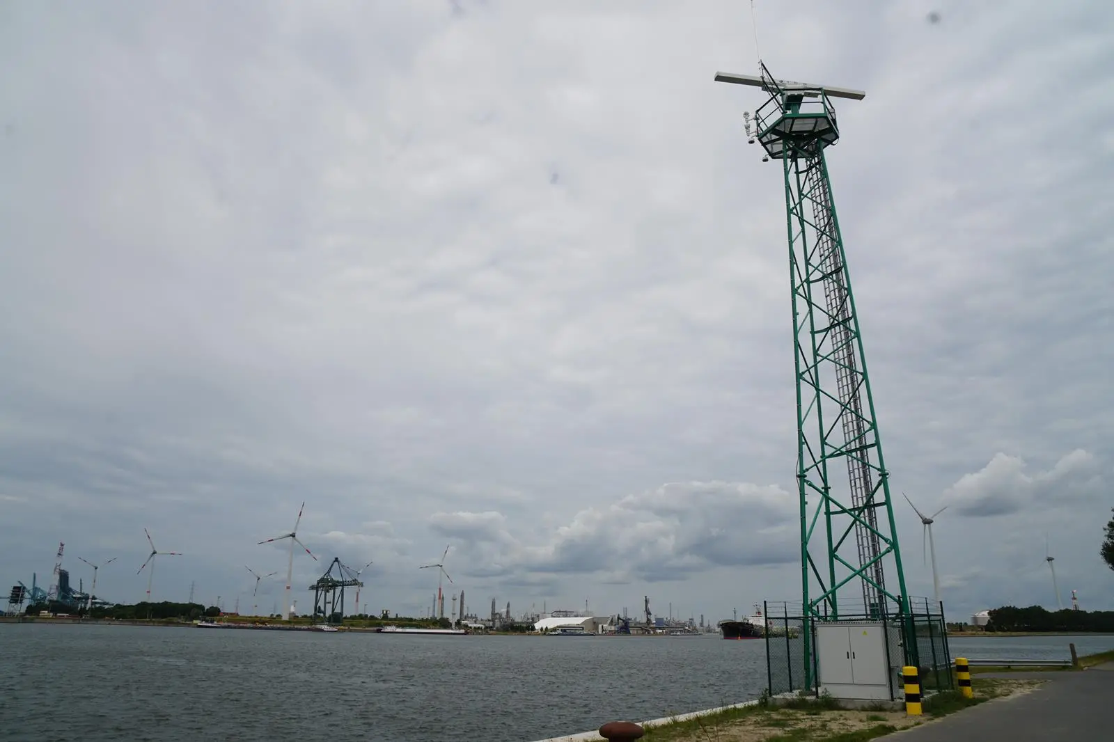
New digital technologies require accurate data, and the Port of Antwerp-Bruges has recently launched an extensive digital radar and camera network that scans the entire Antwerp port area, some 120km2 with 11,000 hectares of waterways and quays. More than 300,000 shipping movements take place in the port every year. The 460 cameras and 22 radars are directly connected to the Antwerp Coordination Centre and provide operational services such as Vessel Traffic Services (VTS) and the Harbour Master’s Office with a comprehensive view of the port.
The digitisation of the entire network means it is also ready to be connected to the port’s digital twin: APICA (Advanced Port Information and Control Assistant). This digital copy of the entire port area provides a scan every second to create a real-time picture of what is happening at the port based on thousands of pieces of data from a network of cameras, sensors and drones. The smart cameras are equipped with specially designed AI that allows them to recognise ships. In combination with detailed radar data, this real-time data will further increase situational awareness in the future in order to evolve towards predictive behaviour.
“This network is a great asset to our port in terms of safety and operational efficiency. The new sensors form the technological backbone of shipping guidance. In the past, there were a few blind spots in the port area where we had no insight into unexpected shipping movements or incidents,” says Rob Smeets, Chief Operations Officer Port of Antwerp-Bruges. “There isn’t a single centimetre of the terrain that escapes this extensive network.”
Regulatory services are also being targeted by ports, beyond the requirements of the FAL Convention’s single window data exchange being mandated from 2024. Singapore’s Maritime and Port Authority of Singapore (MPA) has been building on port processing efficiency with the launch of its digitalPORT@SG™ system which simplifies regulatory transactions and streamlines the port clearance application process. It streamlines up to 16 regulatory applications that were previously submitted via three separate portals, resulting in an estimated annual savings of 100,000 person-hours in the submission of regulatory requirements for the declaration of ship arrival and departure.
Building on this, real-time information and just-in-time operations will facilitate the scheduling of port resources required by ships. This will lead to faster ship turnarounds, shorter dwell times at anchorages, better operational efficiency, and reduced greenhouse gas carbon emissions by ships in port.
Digital Shipping Corridor
Singapore continues to expand its digital reach with several green corridor partnerships. In June, discussions commenced on the establishment of a Singapore-Australia Green and Digital Shipping Corridor by the end of 2025. This includes the establishment of low and zero-carbon fuel supply chains and greening port services and shipping operations to accelerate the development and uptake of green marine fuel sources. Collaboration will also involve the identification of digital shipping solutions to facilitate efficient port call and flow of goods, and paperless handling between ports in Australia and Singapore.
The MPA has also signed an MoU with Wärtsilä with the aim of making port operations more efficient by developing reliable, secure, and cost-effective data exchanges between vessels and port operations. An operational concept for vessels and harbour craft utilising AI-based monitoring, tracking, and incident response, is also planned.
Just as ship operators are able to reach out to ports for more data and collaboration, ports are reaching out to ships on the digital networks being created.
Related Articles
 ALTERNATIVE FUELS & LUBRICANTS
 GENERAL NEWS
 GENERAL NEWS