



BV conducts first survey by drone
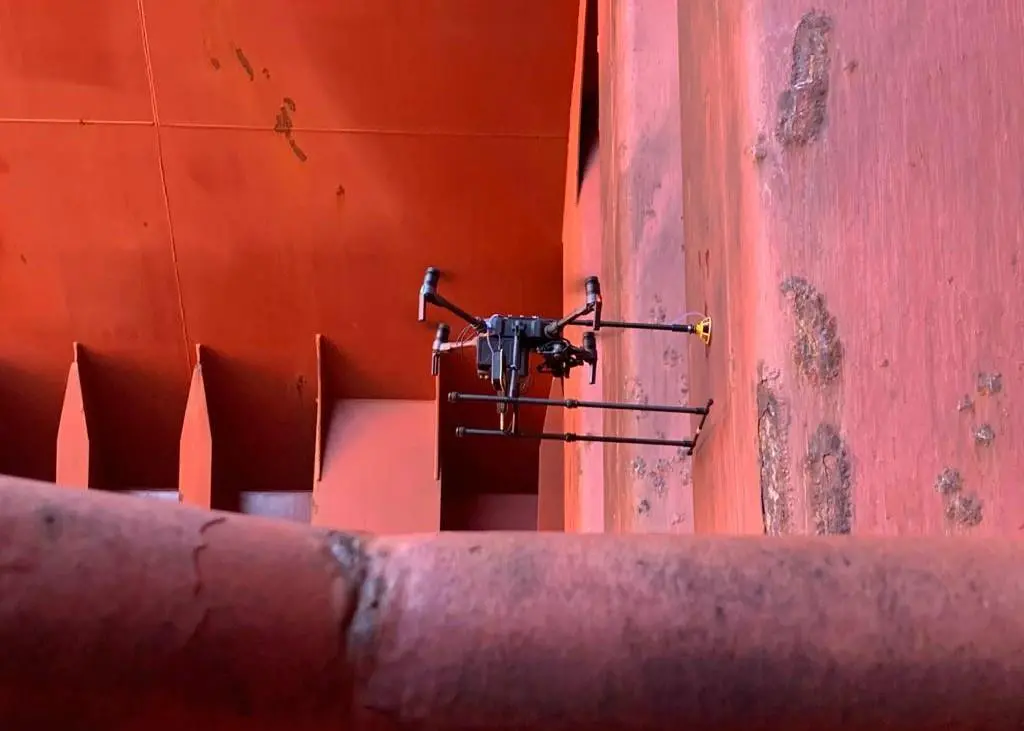
The scope comprised close-up inspections and ultrasonic thickness measurements (UTM) conducted by the drone in two cargo hold spaces. Remote Inspection Techniques (RIT) have been covered by BV since 2019 and the drone operator involved in this survey is certified by BV for both RIT and UTM.
Laurent Leblanc, senior vice-president, technical & operations, said, “This is another milestone in the Bureau Veritas global strategy of digital classification using digital technologies to transform the operating model of classification for the benefits of its clients.
“Drone surveys and our remote survey capability and service delivery are really just starting to make an impact on our clients. They are a vital development for the future of classification. Now we can both see and decide remotely.”
Compared to traditional survey practices, the benefits of using drones include the reduction in time and cost in needing staging, raft surveys or rope access specialists alongside the drone’s capabilities to take accurate measurements.
Use of drones also provides safer conditions for the surveyor and the operator who are not exposed to the risks of working at height nor required to enter the confined spaces for the inspection, the potential for better quality evidence ad optimised maintenance costs and planning by reducing the ship’s immobilisation.
Related Articles
 ALTERNATIVE FUELS & LUBRICANTS
 GENERAL NEWS
 GENERAL NEWS