



Mapping the future: advances in camera technology
The use of drones as a remote inspection technique (RIT) has increased since class society DNV GL first began using camera-equipped drones in surveys in 2016. The use of drones as an alternative to close-up surveys is permitted under both DNV GL rules and IACS Unified Requirements, and offers reductions in survey time and costs, and improvements in terms of the safety of surveyors. However, there have been some limitations on the scope of inspections using this advanced technology.
DNV GL has launched its own drone for carrying out onboard surveys. ADRASSO (autonomous drone-based surveys of ships in operation), as the drone has been named, has been developed to help minimise the risks of carrying out onboard inspections, and to extend the capacity of drone-based ship inspections.
The drone uses hyperspectral imaging technology, which has been used in other industries for some time, but is now being applied in the marine industry. Hyperspectral images pick up on more colours than normal vision, where we see light in the three-colour spectrum of red, green and blue. As a result, it can give a more detailed and in-depth picture.
Currently, the drone is still under development with further work being carried out in the area of data collection. But, Øyvind Smogeli, programme director digital assurance, DNV GL explains that this technology will be able to assist surveyors when carrying out surveys, especially when looking for cracks and fatigue lines in the tank.
The drone will be able to give a surveyor a clearer and more detailed view of what they are looking at, without having to go into the location themselves. A further advantage is that the imaging will be able to detect any rust under the tank coating that the human eye may not be able to see. The camera has been developed by Norsk Electro Optikk and weighs 30kg.
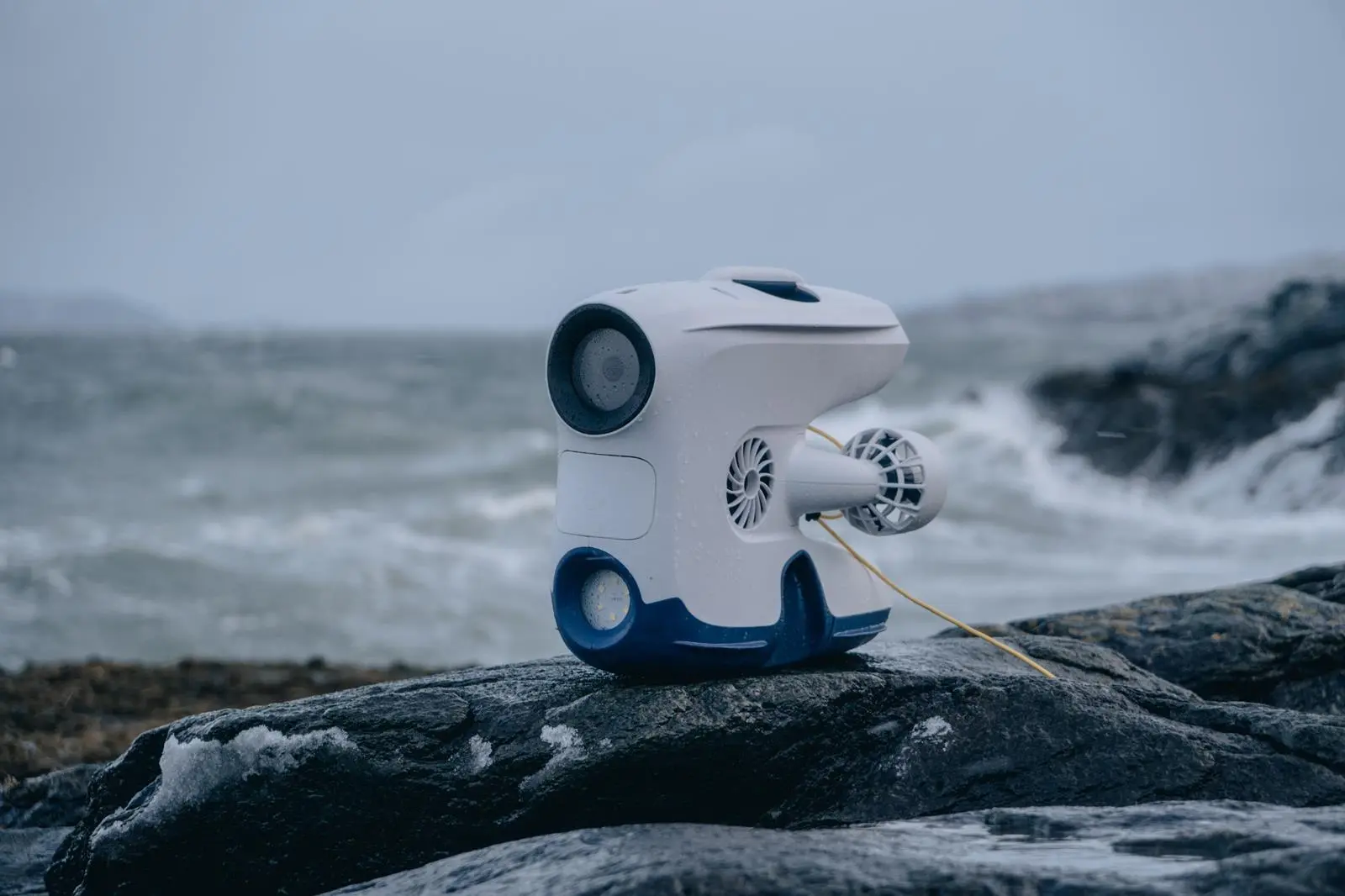
Another company that is also developing camera surveying technology for the industry is Blueye Robotics. The little ‘ROV in a box’ has been used to explore the deep depths of the ocean and in recent developments is now partnering with Inchcape Shipping for marine inspection and surveying of its vessels in ports.
The Blueye ROV (remotely operated vehicle) was developed to be as user friendly as possible, with a steering pad styled on a ‘gaming’ control console and to be able to carry out marine inspections at a reduced cost. Just over 600 units of the Blueye Pioneer have now been sold to the market and being used for various purposes around the world.
Erik Dyrkoren, ceo, Blueye highlighted the savings that can be made with the ROV with a recent project on a Maersk drill rig. He notes that where instead of calling on oceaneering and paying €100,000 a day, a company can purchase a Blueye Pioneer for €10,000 to carry out the survey. “That is the type of cost savings we can see in that industry. Adopting is always slow due to regulations and demands on the technology being bought in that industry, but it’s happening.”
The ROV measures 485x257x354mm and weighs 8.6kg. It is fitted with 4 x 350w thrusters to manoeuvre it and also a tether to upload the images back on the surface.
Another Norwegian digital technology company is seeking to apply camera and drone technology to as the aquaculture, marine and oil and gas sectors. Ecotone is one of the companies that has launched its pioneering hyperspectral imaging camera, initially for the inspection of salmon lice, but as CEO, Oddbjørn Rødsten explains there are further applications which the camera can be used for, such as pipeline inspection and mineral mining.
“We are working with different survey companies, but the most interest we are getting now is the seabed mapper”, says Rødsten, “What is coming is more inspection of subsea installations because the amount of subsea installations are increasing and the information that you can get through hyperspectral cameras you cannot get from other cameras.”
Ecotone notes for seabed mapping the technology will enable more detailed mapping of habitats and sediments of the sea floor and give a better overall view of the area.
Related Articles
 OTHER EQUIPMENT
 LNG
LNG
 GENERAL NEWS