



New tool to map the US ECAs
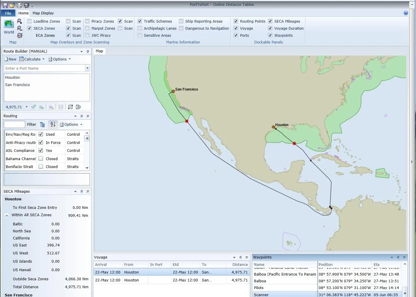
AtoBviaC, a UK computer software company, has developed what it says is the answer to cost control during ECA affected voyages with its new Port to Port software – an online version of the BP Shipping Marine Distance tables.
The software gives the user the ability to calculate distance in both the North American ECA and Sulphur SECA.
Captain Trevor Hall, director of AtoBviaC, said: “Our research has shown that it is rarely cost effective or practical to avoid these routes entirely. It is however, essential to accurately calculate in advance the impact on vessel operating costs and to identify where a slight adjustment of route will avoid unnecessary incursion into an ECA.”
He added: “With only a few weeks to go until implementation of the North American ECA, ship operators need to be aware they are on a countdown to unexpected costs if they do not make the correct provision for the additional fuel costs they will incur.”
The new AtoBviaC route maps enable users to purchase a block of distances while the route scanning ability provides distances within the various SECAs, ECAs and Load Line Zones via marine information map overlays.
For vessels operating within the North American ECA from 1 August 2012, sulphur content of fuel oil used on board must not exceed 1.00%.
Related Articles
 ALTERNATIVE FUELS & LUBRICANTS
 GENERAL NEWS
 GENERAL NEWS