Getting out of a jam
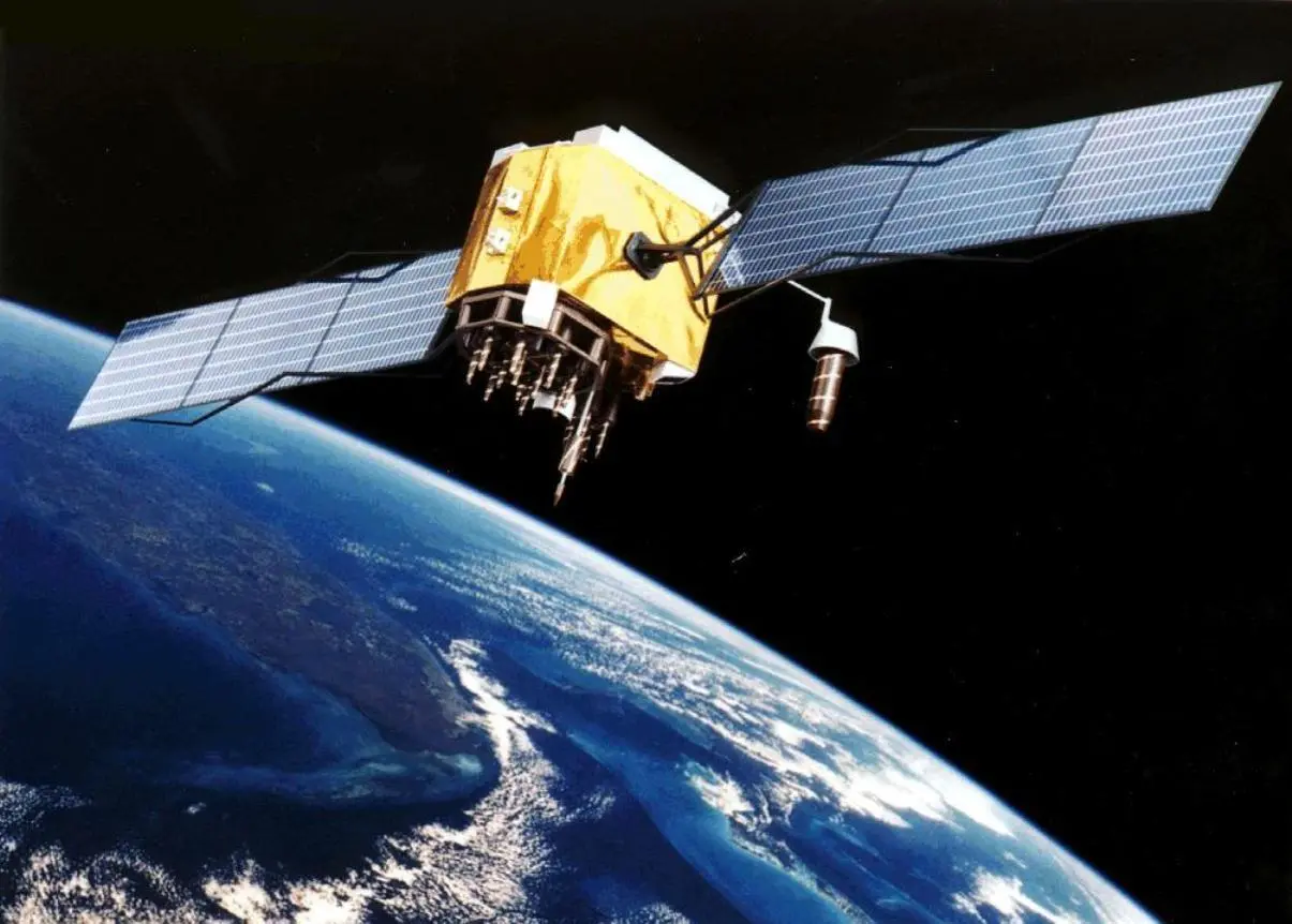
The Global Positioning System (GPS) enables us to pinpoint our location on earth with an accuracy of metres and to tell the time to within a millionth of a second but just how vulnerable is it? Dag Pike originally explored this in The Motorship, Jul-August 2011 issue, but a recent strategy document from Trinity House, the UK lighthouse authority, entitled 2025 and Beyond has highlighted the need for a backup system. It states: “Due to the vulnerabilities of the signal, the need for a terrestrial backup to GNSS is widely accepted in IMO but such a system has not been mandated as yet nor the global or large region coverage defined.”
Jeremy de Halpert, executive chairman at Trinity House told The Motorship: “GPS is a brilliant tapestry of satellites around the world which gives 10m accuracy and nanosecond timing and it has proved to be highly reliable. It is undoubtedly the primary navigation system at present and it will be joined by other satellite systems such as Glonass, Compass and Galileo. But GPS is basically satellite – a 100w light bulb at 12,000 miles in the sky. The amount of power that each satellite generates – and you will generally pick up four at a time – is extremely small and therefore it is very easy to jam either accidently or on purpose.” It is for this reason that an alternative to GPS is being sought.
To give an idea of just how easy the signal is to jam, de Halpert explains: “A GPS runs on a very narrow frequency band at about 1.6GHz and it doesn’t really matter whether you are picking up GPS or the Russian GLONASS, or the Chinese Compass, or in the future, European Galileo. They all run in a very fine bandwidth on about 1.8GHz. So if you have got a reasonable broad band jammer that is going to jam anything between 1.5 and 2.0GHz then it is going to wipe out any satellite signal that is up there, and 3mW will jam the Dover Straits.” This makes it pretty easy to jam and cause chaos in one of the busiest shipping lanes in the world.
“We are talking about pretty agricultural jamming here and that is what we worry about in Trinity House because we are mandated by the IMO to produce a primary and secondary navigation stream,” says de Halpert. “The primary navigation stream is GPS, which is why we run our differential GPS system which monitors the integrity of the GPS signal, irons out any anomalies, and re-broadcasts it.”
The secondary system comprises buoys, beacons and lighthouses. If GPS is sufficiently vulnerable for the primary system to go down at any time, it would then be necessary to resort to the backup. “The backup costs UK Limited (England, Scotland and Ireland) in the region of about £80 million a year to provide buoys, beacons and lighthouses and other navigation marks,” explains de Halpert. “The way that ships are operated now (and we run the largest deep sea pilotage authority in Northern Europe, so we know what happens on the bridges of big commercial ships) the officer of the watch and captain are generally slaved to their electronic chart display or system (ECS). They are going to look at that and say that is gospel.”
Reverting to paper
The skills needed to revert back to the old fashioned way of navigating with chartwork, pencils, rubbers and parallel rulers etc are fading fast. The skill is retained in the UK’s Royal Fleet Auxiliary (RFA) and the Royal Navy, and perhaps in major cruise operators such as P&O or Cunard, but it is generally fading in most merchant ships. “The IMO has mandated that if you have two independent electronic chart displays you can dispense with paper charts altogether, which is where we are now,” says de Halpert. “The diminishing ability to revert to the secondary means gives us a worry, because if we are responsible for navigation and safety around the coast, and the primary means has now become the only means – and it is inherently vulnerable – should we then start doing something about it?” he asks.
The answer to that question has to be a resounding ‘yes’ and although five years ago Loran stations were being shut down in the UK, as in most countries around the world, Trinity House decided it needed to take stock of the situation. “We were worried about this particular issue – the vulnerability of GPS – so we said just before we do this, can technology come to the aid of the Loran system?” he confides.
What was required was a way to reproduce, at low cost, a low frequency high power radio signal through the Loran aerial chain, which will produce 10m accuracy and nanosecond timing accuracy delivering a basic GPS equivalent at low cost and coastal range. This is something that is becoming known as eLoran. “We have been running a trial that proves very conclusively that it can be done and that it will maintain that accuracy whether you are coming in and out of Harwich or going around the Orkney Islands,” de Halpert told The Motorship. The system has been tested rigorously, and in the UK operates from an aerial at Carlisle Anthorn, near Carlisle. “There are two aerials in France, four in Norway, one on the Faroes and one in the German islands off Denmark,” he explains. “That gives us a triangulation of a system that will produce day-in day-out 10m accuracy and nanosecond timing and that is working now.”
eLoran launch date
The trial is scheduled to finish in 2013, “at which stage we will be at initial operation capability, so we would be ready to launch at that stage,” de Halpert explains. Manufactures are already onboard and are mostly located in the USA. “There is a company called Megapulse Inc that builds the generators and Ursanav that builds generators and aerials.”
Trinity House is trying to persuade other countries as to the merits of the system. “At the moment Saudi has bought into it and they are going to completely redo the Red Sea and Persian Gulf coverage. South Korea wants it for there and they have got Japan and China interested.”
South Korea is currently having its GPS signals jammed by North Korea. “Because of our connections with Norway on the Northern European trail run, Russia is hugely involved because the Polar route is now opening and navigation using satellite navigation at high latitudes is extremely inaccurate,” explains de Halpert. “So they want a clear backup there with all the pollution/environmental threats they have.”
He concluded: “People are slowly starting to realise that although it may not seem like a great commercial asset, it is an extremely cheap and reliable insurance that is needed.” So unless you want to go back to paper charts, the only way forward might be to adopt eLoran, which could be made to provide an accurate alternative to GPS. This could keep navigation using primarily electronic means without a huge amount of cost and get the marine industry out of a fix. Or at least provide it with an accurate alternative if GPS is jammed.
Gearing up for ECDIS
The ECDIS carriage requirement is one of the first mandatory requirements that have come in force during the last years that really can enhance navigation safety. “With ECDIS, the crew can finally, fully benefit from the installation,” says Anders Rydlinger, Transas’ product director navigation. “This requirement has also speeded up the technology development, as well the production of official ENCs.”
He told The Motorship: “There is a strong will and determination within the industry to implement new technology onboard and a wish to see some operational benefit from this process, not just a cost and a logistical obligation.” He believes that there will be no need to extend the 2012 deadline for the fitting of ECDIS to new builds.
“For retrofit, we talk about 2013 to 2018,” says Rydlinger. “The industry is ready and it should be no problem for shipowners to plan this and be ready in time if they start now. The bottle neck might be to get all officers trained so that ECDIS can be used in a proper way enabling crew and shipowner to benefit from ECDIS.” It is for this reason that the company has launched a training service via its CBT and Transas ECDIS global training network (GET-Net).
“Transition to ECDIS and the implementation of new procedures takes time,” explains Rydlinger. “With proper setup and usage, streamlined procedures (ISM) on the vessel and in a shipping company as well as a trained and motivated crew, ECDIS is an investment with huge potential for cost savings. At the same time, efficiency and safety are increased.”
“Savings can be immediately realised, with real savings potential in the areas of charts, fuel consumption and time spent on planning and preparation of reports,” he told The Motorship.
“Our conclusion today is that it’s been a long but rewarding way, since our navigation officers and crew report back that the system makes them feel more secure, and that the operation of the vessel is safer,” says Captain Tor-Arne Tonnesen, maritime superintendent, Norwegian shipping company Solvang.