Voyage optimisation supersedes traditional weather routing
Despite the claims of weather routing service providers to save fuel, increase safety and improve schedule-keeping, ships still founder, hundreds of lives are put at risk and thousands of containers are lost overboard every year. A significant improvement on this dated concept comes in the shape of voyage optimization.
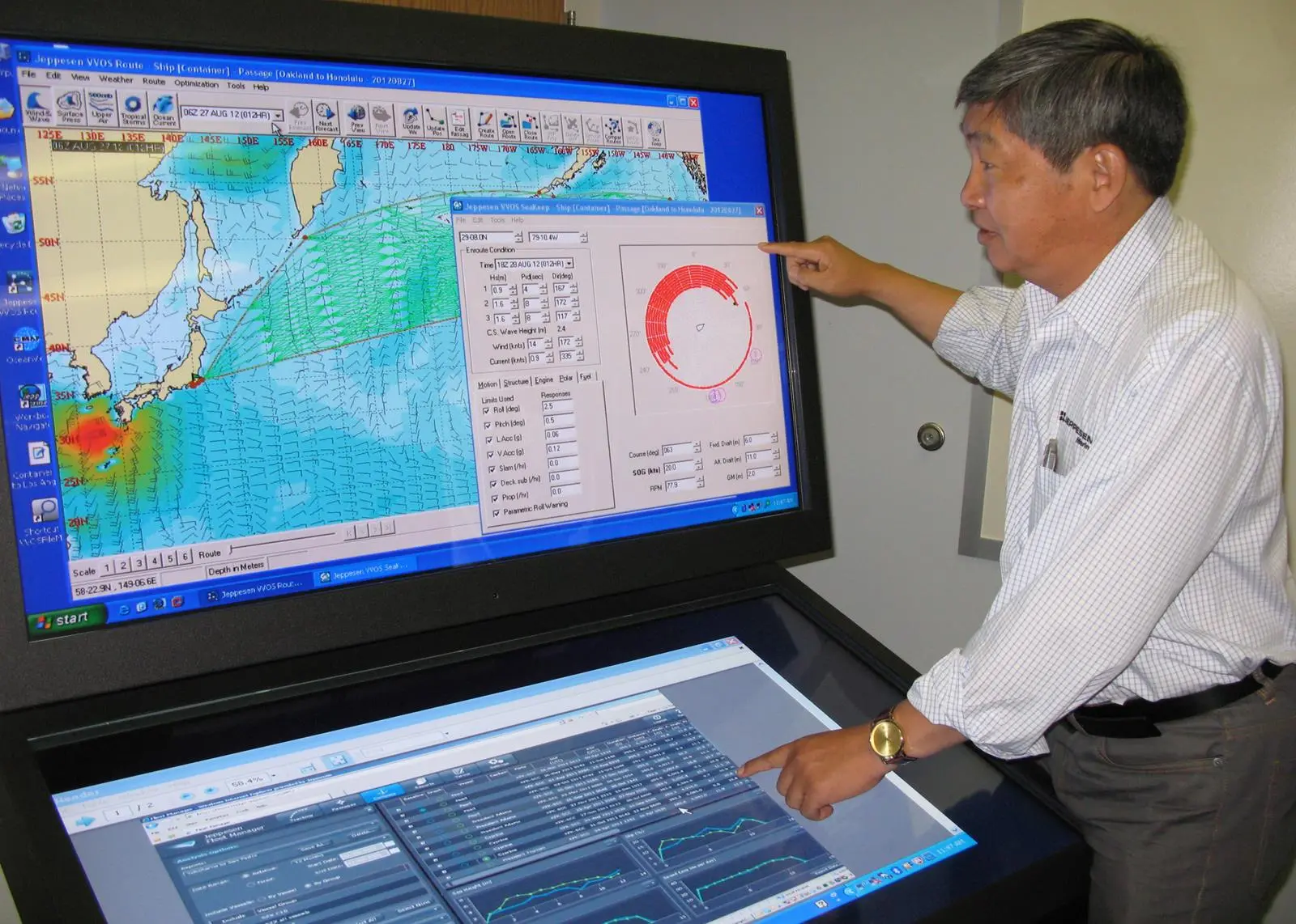
An IMO study (MEPC58/INF.21) indicated that while weather routing can achieve 2% to 4% reduction in fuel consumption and associated greenhouse gas (GHG) emission, even greater improvements can be achieved through technical and operational measures such as speed and route management and fleet deployment planning. Jeppesen, a Boeing company, launched VVOS to deliver a return on investment that exceeds traditional weather routing methods.
The advent of supercomputers and numerical models has significantly improved the accuracy of weather forecasts over the past decade. However, the accuracy of each model varies due to model resolutions, how the physics are implemented and many other factors. The national forecasting centres tend to calibrate their models to perform better when storms threaten their own countries, but pay less attention to mid-ocean storms passing shipping lanes.
None of the models can consistently produce accurate forecasts for tropical cyclones due to their complex physics and rapid development. Human forecasters are employed during the typhoon or hurricane seasons to issue track and intensity forecasts based on consensus of model outputs, as well as past experience. Depending on the location and season, the accuracy starts to deteriorate after three to five days, leading to even larger uncertainties between five and seven days.
Use of ensemble forecasting allows us to quantify the uncertainties in the prediction. It is now possible to estimate the probability of exceeding a given threshold, e.g. 7m of wave height under a nominal forecast of 5m. The threshold can be established based on motions and seakeeping events which define the risk of heavy weather damage.
While one route may yield fewer uncertainties for on-time arrival, it would also consume considerably more fuel than using another route. This type of simulation offers the user the ability to trade off fuel consumption versus ETA and to estimate the schedule reliability for planning port and terminal operations.
Most weather routing software solutions use variations of Dijkstra’s algorithm, in which the program simulates a vessel departing with full power toward the arrival port with different headings. After each time interval (e.g. six hours), the ship’s dead-reckoned (DR) position forms a so-called isochrone until it arrives at the destination.
Unfortunately, the algorithm ignores one important option: speed management. As storms move across the ocean, it is possible for the ship to slow down and let them pass and then catch up, instead of sailing a longer distance to go around, or ‘hove-to’ in bad weather. Such a strategy can significantly reduce fuel consumption for a given arrival time as well as reduce the risk of heavy weather damage when fully implemented with ship response and engine overload.
If speed and heading are both considered in the route optimisation algorithm, the computation will be more accurate because it solves a multi-dimensional problem. Without the fundamental principle of modeling the ship’s performance in various loading and environmental conditions, it is not possible to minimise fuel consumption for a given arrival time without exceeding safe operating limits.
Cost-cutting trends in the shipbuilding industry and marine classification societies can result in reduced design safety margins in ship structures. Shipyards use sophisticated finite element models and high tensile steels to reduce steel weight and production costs in order to be competitive. Similarly, the propulsion systems are often optimised for calm weather trial conditions in order to satisfy recent EEDI requirements.
One consequence of this is coupling low-speed diesel engines with direct-drive high-pitch propellers and low acceptable sea margin. In calm weather conditions, a lightly loaded vessel with a clean hull easily maintains the contracted speed in accordance with the EEDI. Unfortunately this can lead to frequent engine overload when the ship encounters high wind or seas, or when propeller and hull fouling raise resistance.
A ship slows down either involuntarily due to increased resistance from the wind and waves, or voluntarily due to navigation hazards or fear of heavy weather damage from excessive ship motion, propeller racing, slamming, or boarding seas. Any optimised route solution must take both involuntary and voluntary speed reductions into account when estimating DR ship positions in relation to the movement of weather systems. Otherwise, the recommended route could lead the ship into a dangerous situation.
Furthermore, if weather routing tools cannot predict such events, they can lead to over-predicted ship speed and wrong diversion decisions when facing heavy weather, not to mention inaccurate estimates of fuel consumption and time of arrival.
The capabilities of weather routing have evolved into the science of voyage optimization. Today’s technology enables accurate ship seakeeping performance predictions and intelligent, informed operational decisions that can help masters save fuel, reduce GHG emissions, and avoid heavy weather damage.