Operators wary of ECDIS risks
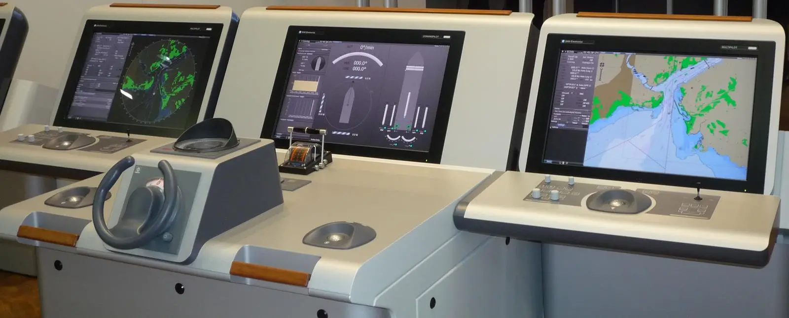
The industry has voiced its support for technologies such as Electronic Chart Display and Information Systems (ECDIS) which should improve the safety of shipping but nobody has said it is going to be easy. Concerns continue to be raised by operators around the world as they move towards compliance with SOLAS Chapter V amendments which make ECDIS mandatory from 1 July 2012 to 1 July 2018 at the latest.
“The older generation of navigators who have spent a lifetime navigating on paper-based systems, are finding the change onerous,” says Captain Sanjay Mittal, general manager at Epic Ship Management in Singapore. “The younger lot, which is more computer savvy, has taken to it readily but without fully appreciating the limitations. There is an over-reliance on the electronic information and basic navigation skills are therefore being blunted. In simple parlance, the navigators are forgetting to ‘look outside the windows’.”
NYK of Japan has begun installing ECDIS on its vessels, and its training centre in Singapore has received class and flag state approval for conducting ECDIS courses. NYK also has concerns that an over reliance on the equipment could lead to accidents. Additionally, there is concern about the possibility of equipment failure and paper charts not being available for use in case of an emergency.
Torm of Denmark has purchased 120 ECDIS systems from Norwegian company Maris and conceived the idea of zero downtime that involves the installation of a third unit as a ‘hot spare’ to ensure ECDIS is available at all times. According to SOLAS V/22 16.2 regulations, while ECDIS malfunctions will not necessarily make a ship unseaworthy or provide a reason for delays in port, suitable arrangements must be “made by the master to take the inoperative equipment or unavailable information into account in planning and executing a safe voyage to a port where repairs can take place.”
According to Steinar Gundersen, deputy chief executive of Maris, while IMO rules are clear, it remains to be seen how individual flag states and port state controllers will interpret them. “The Zero Downtime ECDIS concept has been devised to avoid potential delays so that a ship can always proceed to the next convenient port of call.”
There is no methodology for port state control or pilots to verify how up-to-date the software is on ECDIS, says Nick Cutmore, secretary general of the International Maritime Pilots’ Association. “Our guidance to members is: be careful out there. ECDIS certainly isn’t any more accurate than paper charts and is often less accurate.”
Work needs to be done by manufacturers and hydrographers, he says. “There are still what we euphemistically call operating anomalies.” These include the disappearance of shoals when merging data from different sources. “There are some recognised shortcomings in the software: inadequate depiction of shoal water, incorrect display of obstructions, incorrect display of wrecks, incorrect display of light sector arcs, naming of features unclear, major landfall lights not clearly distinguishable from minor sector lights. That’s pretty heavy stuff.”
Equipment and services providers are guiding operators to the benefits of their systems. “We see the ECDIS mandate as not just a required replacement for paper charts but as an opportunity to equip ships with a suite of tools that will increase overall situational awareness, safety and efficiency. If shipowners and operators embrace this technology, they will not only be able to plan better and safer routes, but utilise data and analytics from their entire fleet to increase efficiencies and improve their operations,” says Christine Pomorski, marine communications specialist for chart provider Jeppesen in the US.
BACK OF BRIDGE
The company has published a guide, ECDIS What you need to know, and is introducing two new products in the upcoming months: a free service that will allow users to download Notice to Mariners to their databases where they are viewed as a separate chart overlay and a new Jeppesen Nautical Station which is a ‘back of bridge’ system that allows users to manage and license their chart portfolios, plan routes and monitor weather and piracy information.
Thomas Gunn Navigation Services of the UK is also looking at ‘back of bridge’ functionality. The company’s Voyager software is an internally developed solution that currently caters for paper Notice to Mariners as well as handling all updates on a weekly basis for the Admiralty’s Digital services and other merchant vessel notices. The latest version of Voyager allows digital updates to be applied at the click of a computer mouse, and if a vessel is sailing using ENCs and ADP, the corrections are applied in full within minutes. Auditable reports are available which provide comprehensive reports on the updating of all admiralty publications, charts, and ENC’s held on board.
The ‘back of bridge’ solution the company is developing will pull together all that a mariner needs to plan and prepare a passage then execute and monitor that passage all under one platform that is interactive and intuitive. The functionality will include the ability to identify ENCs required for a passage, compare that to current holdings on board and within minutes, have the permit sent back to the navigator, for the additional coverage required.
Operators are recognising the value of the functionality being offered by equipment suppliers. Captain Alex Andriano, marine superintendent at Crew Chart Ship Management in Sweden, has overseen the move to paperless navigation for several vessels. “The benefits are amazing,” he says. Combined with a ship’s AIS signal, the technology offers greatly simplified voyage planning and tracking. Added functionality such radar overlay, online update, pirate alert and ice chart are also greatly beneficial. Crew Chart has installed Transas and Furuno systems.
Andriano’s wish list, like that of many other operators, is headed by screens, at least for the voyage planning system, being larger, to match paper chart sizes, and for common functions such as range, bearing line and scale to be standardised across systems.
Should all ECDIS have a common menu structure? “This is highly unlikely to happen,” says Mal Instone, director of operations and standards at ECDIS Ltd, a company in the UK that provides navigation training, purchasing, charting and consultation. “Look at radar – do we have a common menu structure or keyboard? No, and radar has been in existence for a considerable period of time. ECDIS manufacturers are likely to argue against such a move on the grounds that doing so would stifle technological advances in the field. It would also limit the customer’s choice and reduce competitiveness in the market if they all looked the same. It also assumes that manufacturers could agree on how the menu structure should look.
“It is very difficult to make a product like ECDIS homogenous without stifling advances and allowing freedom of innovation. However, one thing that I think the IMO could successfully implement is the use of a common set of abbreviations for ECDIS functions (such as XTD/OTL etc).”
ANALYSIS OF USER NEEDS
IMO’s correspondence group on e-navigation, led by the Norwegian Coastal Administration, is in the process of collecting user needs and carrying out a gap analysis. The gap analysis is based on the list of user needs that was endorsed by IMO’s NAV sub-committee in 2010, and will be followed by risk and cost/benefit analyses before the presentation of a final strategy implementation plan in 2014.
The scope of the project includes evaluation of the need for consistency in ECDIS presentation and some examples of needs that have been identified are that equipment familiarisation should be intuitive as symbology, material requirements and workstation layout are standardised. The mariner should have access to all available nautical information and a default interface setup option accessible by one touch (S-mode). The International Hydrographic Organization S-100 data model has been chosen as a basis. The strategy will also address training, competency, language skills, workload and motivation. Alert management, information overload and ergonomics are prominent concerns being addressed.
TRAINING ISSUES
ECDIS training is a major concern to Captain David Patraiko, director of projects at the Nautical Institute in the UK, and his concerns are echoed by NYK, Epic’s Capt Mittal and others. “We are very concerned about ECDIS training,” says Patraiko, who believes there should be a strong emphasis on the generic training. “IMO recommends that the model course should take about 40 hours to complete and we know that there are courses out there that governments have approved that are one or two days,” he said.
The Nautical Institute is working on best practice for ECDIS training with organisations such as BIMCO, Intermanager, Intertanko and the International Chamber of Shipping. “This is industry saying we don’t think you can achieve the competencies identified in the model course in such a short time.”